Mapping Themes
Themes are a convenient way to quickly load multiple layers related to a particular technology or resource without having to manually browse and add layers to the map.

A comprehensive online mapping tool that helps to identify areas that are suitable for power generation and other energy-related projects

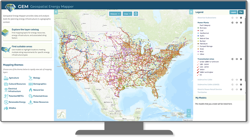
GEM is an interactive web-based decision support system that allows users to locate areas with high suitability for power generation and potential energy transmission corridors in the United States. Explore energy data on the map, browse and download data layers, generate dynamic reports on a variety of topics, or create a custom suitability model to identify areas for energy development.
Subscribe to the GEM mailing list for webinar invitations, newsletters, and announcements

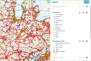
GEM offers an extensive catalog of mapping data for energy planning, including energy resources and infrastructure, and other information that may influence siting of energy infrastructure.
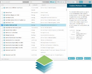
Reports on a wide variety of topics can be generated for user-specified areas.

Interactive, flexible suitability models help identify areas meeting a set of technology-specific siting criteria.

Themes are a convenient way to quickly load multiple layers related to a particular technology or resource without having to manually browse and add layers to the map.
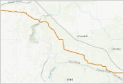
Potential routes for transmission or pipeline corridors can be generated using modeling, sketched on the map, or loaded from files.
Geospatial Energy Mapper (GEM) is a next-generation modeling tool built on the core data and capabilities of the Energy Zones Mapping Tool (EZMT). GEM features an improved user interface, updated data, and additional capabilities. Argonne National Laboratory hosts the tool with funding from the U.S. Department of Energy (DOE) Office of Electricity.